
The history and development of the Norfolk Broads
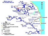
The Norfolk Broads consist of a 120 mile network of rivers across Norfolk and part of Suffolk, based on two main rivers, the Bure (North Broads), and the Yare (South Broads). These two halves of the Broads meet at Breydon Water at the back of Great Yarmouth. The river then goes out to sea through Yarmouth Harbour between Great Yarmouth and Gorleston. There are no locks on the whole of this water way, making it ideal for river cruising. This also means there is no separation between sea and fresh water, and the lower stretches of both Broads is tidal and therefore consists of brackish water. This is important for anglers as obviously it affects the species of fish in different areas. This also means that the river level in the lower 10 miles or so tends to rise and fall with the tide. This is important when mooring boats, as spare rope needs to be left.
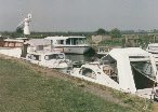
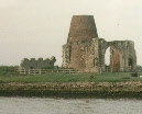
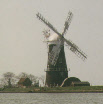
The North Broads has a much greater range of Broads and rivers, with the river Ant and Thurne, and the Broads of Wroxham, Salhouse, Malthouse, South Walsham, Barton, Sutton and Hickling. This whole area provides a much more diverse “Swallows and Amazons” feel and has become the favoured area for most holiday makers. There are the really beautiful natural places to visit, such as the “beach” in Salhouse Broad, The famous windmill at Thurne Dyke, the subject of chocolate boxes and jig-saws, and of course the old abbey, St Benet’s, where all the rivers seem to meet. As more holiday makers want to start their boating holidays in this area, this has lead to the development of many boatyard and hire craft companies. The bridges at Potter Heigham and Wroxham, have limited headroom, and so this is the Head of Navigation for the larger holiday craft.This in turn has caused the picturesque villages of Potter Heigham, Horning and Wroxham to develop, with the associated number of riverside pubs, restaurants, moorings and shops. Of course day boats / picnic boats can easily get under both bridges giving holiday makers at the Peninsula a unique opportunity to explore the quieter Amazon-like stretch from Wroxham bridge to Coltishall, about a 2 hour cruise through mainly forest areas.
History of the formation of The Norfolk Broads.
The Broads originated in the Middles Ages, during the 9th to 13th centuries, as shallow pits from which generations of Norfolk people dug peat for heating and cooking purposes. Roman mercenaries, Saxon settlers and Norman conquerors all took what they needed, but it was not until the Middles Ages that peat-cutting became organized.
The monks of St. Benet's acquired all the rights as well as the services of the peasants, to the peat-cutting, consequently the Abbey became very wealthy. The amount of fuel needed was massive. For example, the monastery of Norwich required 200,000 bales of peat a year and within two hundred years, nine million cubic feet of peat had been cut from the area, creating great holes and deep scars.
During the 14th century the sea level rose, the area flooded, and this natural accident formed the broads as we know them today. This accounts for why the Broads are fairly shallow as large lakes go, and this adds to the relative safety of these waterways for boating holiday makers, and why it is possible to moor up in the middle of a large broad and just drop mud-anchor, something that couldn’t be done for example in the deep Lochs of Scotland or the Lake District.
Over the centuries dwellers settled in the area, to benefit from the numerous Broads and their connecting river-ways, providing as they did a convenient and cheap means of transportation. There was the abundance of fish, within the waters; wild-fowlers, using specially adapted punts, found plenty to live off. Modern man now harvests the reed for roof-thatching and enjoys the Broads for recreational, holiday and educational pursuits. The Broads are many things to many people; for holiday makers and local people they provide a setting for waterborne rest and recreation which is unique in Europe.
